Co Loa Citadel
Introduction
In ancient times, Co Loa was an area located at the apex of the Red River Delta, an important hub of both water and land communication. There were villages and a dense population here. The inhabitants mainly lived by farming, fishing, and hunting. Moving the capital from the midlands down to the delta had extremely important historical significance, marking a new stage of development for our nation.
According to old histories and folk tradition, the citadel was built in nine winding, spiral layers; the spiral center was Xom Chua, and the spiral body was the rampart road from Xom Chua through Xom Cho and Xom Huong to Go Chay; the spiral mouth, or “Loa Khau,” was near the South Gate, close to the Hoang River. Results of surveys from past to present all show the presence of three wall rings, earthen ramparts with moats, rivers, lakes, and many mounds, making a large citadel with a total perimeter of nearly 16 km and an area of about 46 ha. The construction of the wall rings here made full use of natural earthen ramparts, mounds, and high strips of land along the river. Therefore, the walls had no fixed shape but followed the terrain to form two outer rings enclosing and protecting the Inner Citadel. The Inner ring alone was a regular rectangle, where the king, royal family, and court lived, guarded by troops.
Ancient works such as Lĩnh Nam chích quái, Lịch triều hiến chương loại chí, Đại Nam nhất thống chí… all also mention the story of the Golden Turtle (Kim Quy), That Dieu Mountain, and the event of An Duong Vuong building Co Loa Citadel.
Besides the story of the Golden Turtle (Kim Quy), among the people of Ke Nhoi, around That Dieu Son and the Co Loa area, many other myths are still preserved about An Duong Vuong building the Spiral Citadel. These include the story of fairies carrying earth to build the citadel. They worked all night until the rooster crowed to signal dawn, then disappeared. The place where they gathered is called Tien Hoi (Van Canh Commune); the place where they waited for one another is now Cho Market (Yen Phong), along with a series of related place names such as Lo Ferry, Tia Bridge, Hong Bridge, Do Bridge, Han Bridge…
Co Loa was originally called by the vernacular name Cha Chu (Cha – village, Chu – high land). Legend says that before building the citadel, An Duong Vuong gathered the residents living in Cha Chu at Dong Dan mound. An Duong Vuong told the village elders that the king wanted to move the people to the land of To, the first stopping place when the king sought land to establish the capital. But everyone disagreed. An Duong Vuong then agreed: “Elders and people, wherever you want to live, outside the area where the citadel and capital will be built, I will approve and help the people settle down and make a living.”
Everyone who came to the meeting uniformly pointed down to the river. An Duong Vuong then picked up a large pebble, stood on a high mound, and threw it strongly into the river exactly where the villagers had just pointed. Suddenly, a sandbank of alluvium rose in the middle of the river; that place is now Chau Phong Ha Vy village (Lien Ha Commune, Dong Anh District today). The high earthen mound where King An Duong Vuong stood to throw the pebble still remains today, called “Dong Dan” mound, northeast of the Outer Citadel of Co Loa. Chau Phong - Ha Vy village today is also called Quay village (this area has low terrain in Dong Anh District. In the past, whenever there was heavy rain and the Quay area was flooded, the Chu area had a good harvest; conversely, when the Quay area had a good harvest, the Chu area suffered drought. Therefore, folk saying has it: Quay is flooded, Chu thrives; Quay laughs, Chu cries.)[1].
Co Loa Citadel was twice chosen as the capital of the Thuc An Duong Vuong dynasty (257–208 BC) and Ngo Quyen (939–944), and has also had many other names such as Oc Citadel, Loa Citadel, Viet Thuong Citadel, the old citadel of Viet Vuong, Cha Chu Citadel…
According to legend, Co Loa Citadel was built of earth, consisting of nine spiral rings. It is called Co Loa because of the citadel's unique architecture. Based on remaining traces, scientists have found that the citadel has three rings: Outer Citadel, Middle Citadel, and Inner Citadel. The wall rings, on the one hand, were built connecting to and added on top of natural mounds; on the other hand, they consciously avoided the settlement points of pre-Co Loa inhabitants. The outer walls were vertical, while the inner faces were gently sloped. The wall rings averaged 4–5 m in height, with some places as high as 8–12 m. The base was solid, 20–30 m wide, and the top was 6–12 m wide. On all three wall rings there were earthen protrusions extending outward called “fire-return”. All three wall rings had protective water moats. The wall rings had places cut through to make gates; above the gates were shrines to the guardian deities of the gates, built in a later period when inhabitants came to form hamlets.
The Outer ring has a perimeter of about 8,000 m, passing through the territory of four communes: Co Loa, Uy No, Viet Hung, and Duc Tu. This is a closed wall ring following natural mounds, so it has no clear shape. Many sections of the Outer Citadel have been destroyed, and most of the Outer moat has become rice fields. The cross-section of the Outer wall is trapezoidal, averaging 18 m wide and 2.6 m deep. Through archaeological cuts, a layer of stone revetment was found at the base of the wall, above which was a clay layer reinforced with pottery shards to make the wall base firm.
The Middle wall is a closed ring with no fixed shape, about 6,500 m long, running from the South Gate eastward along Dam Ca through Go Voi in the north, then back south along the bank of the Hoang River; it was also built by connecting natural mounds and following lakes and ponds. The unique feature of the Outer and Middle citadels is that they are joined in the south, creating an empty stretch as an entrance. The southern face of the Middle Citadel has almost completely disappeared, partly leveled for roads and partly built over by people's houses.
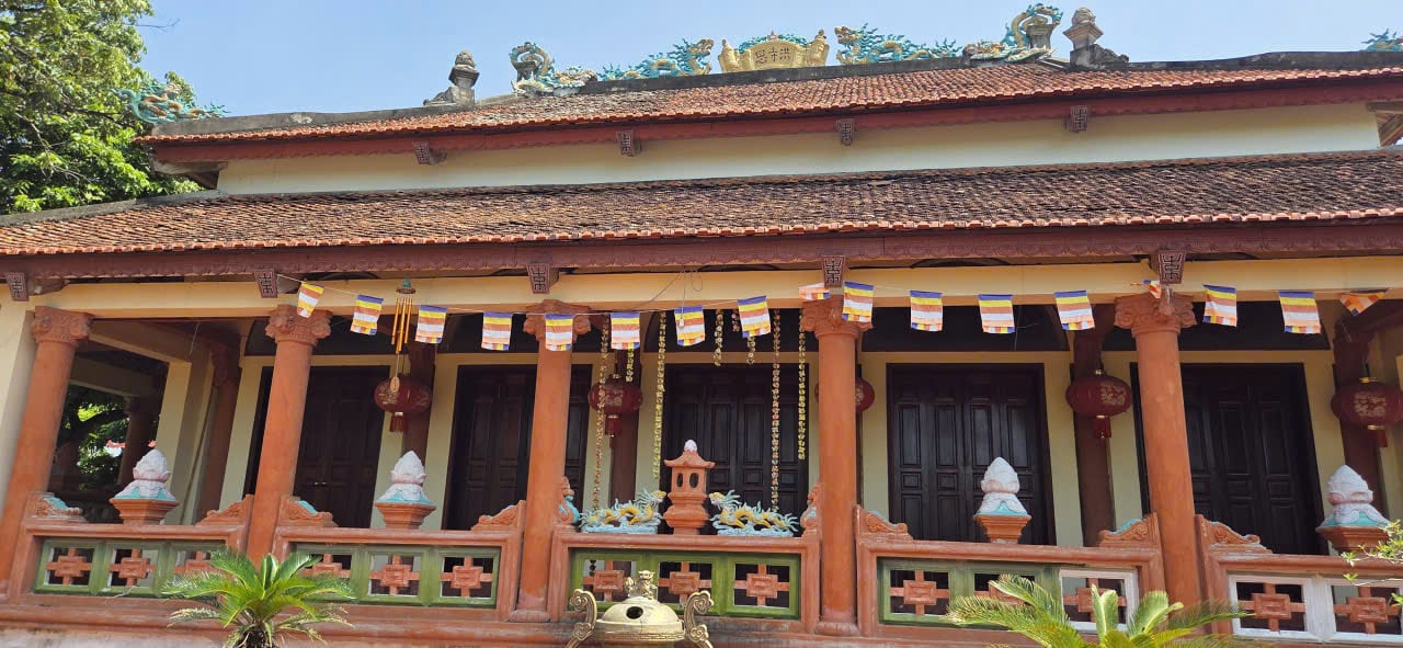
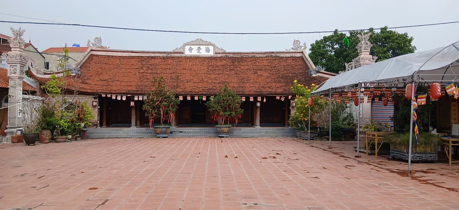
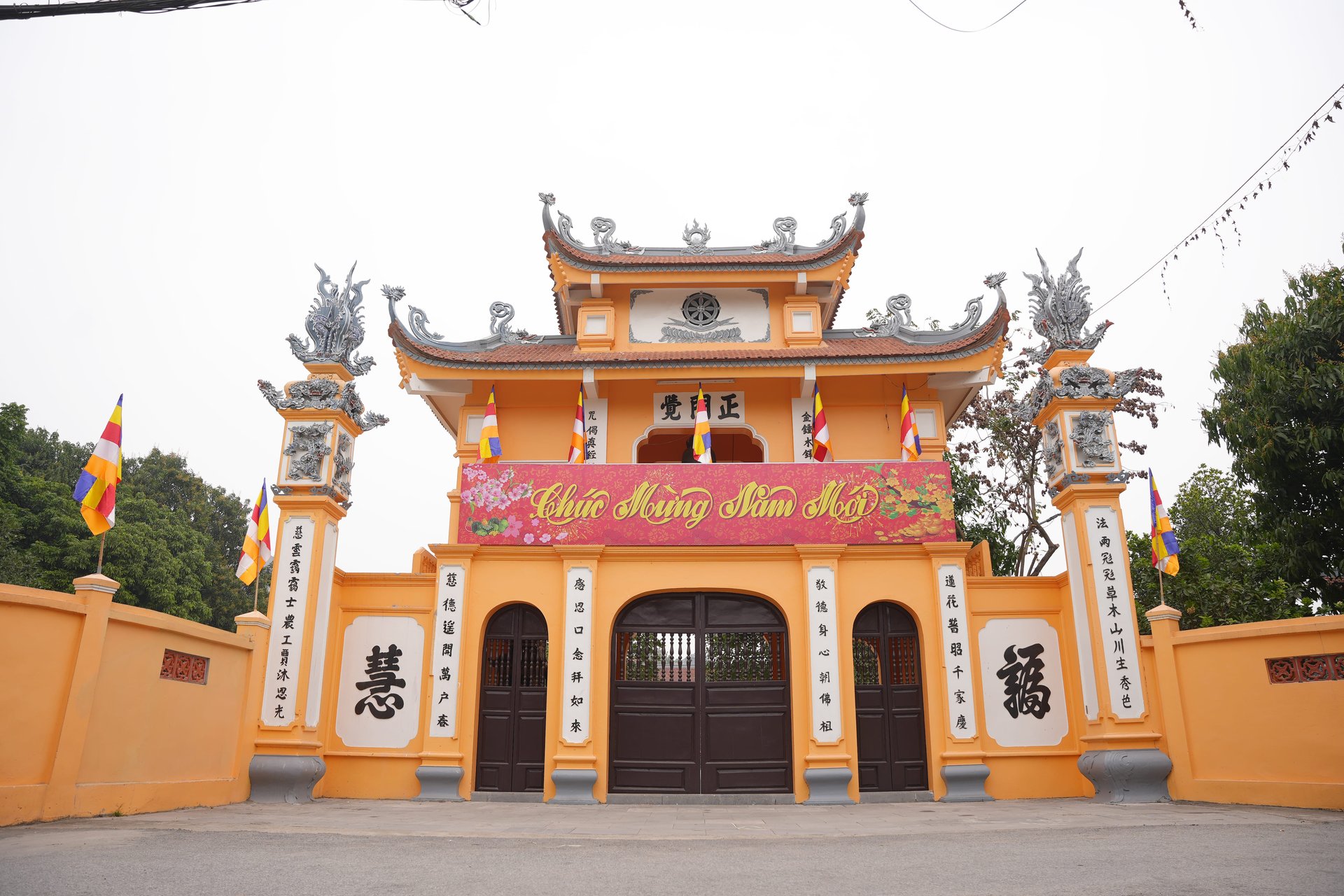
The Middle Citadel has four gates: South Gate, North Gate, Northwest Gate, and Southwest Gate. At the gates, shrines to the guardian deities of the citadel gates were built on the wall surface. The South Gate (shared with the Outer ring) is also the main gate (Front Gate), so two shrines were built on both sides.
The Inner Citadel is completely different from the two wall rings above; it is rectangular, with a perimeter of about 1,650 m, built according to the four main directions: South, North, West, and East, but it opens a gate only in the middle of the southern wall, facing Co Loa communal house. Around the Inner wall, 12 “fire-return”. These earthen mounds were built very symmetrically: each horizontal wall had 2 mounds and each vertical wall had 4 mounds, so that if the citadel were attacked, these “fire-return” mounds would scatter the enemy, and soldiers on the wall could easily use bows and crossbows and spears to destroy the enemy.
The eastern face of the Inner Citadel borders the Middle Citadel and has no forward rampart. Right near the South Gate, close to the Hoang River, there is a round well connected by water to the river, popularly called Loa Khau (snail's mouth). Later, a small shrine was built right near Loa Khau to worship the Kim Quy deity. This shrine is now near Sa Market, 20 m from Loa Khau; it is simply built of brick and mortar, with an arched door and one altar inside. The Hoang Giang River itself was the natural moat for the Outer Citadel on the southwest and south. The remaining moat was dug close to the foot of the wall. From Cot Co mound to Dam Ca, this moat connects with the moat of the Middle Citadel at Dam Ca and Xom Mit, flowing through Cong Gate
Song, connected to five small channels shaped like an open hand. One branch of these channels flowed into the moat ring of the Inner Citadel. In ancient times, the moat system was interconnected and opened to the Hoang River, full of water all year round, forming a complete and unified water transport network; boats could easily travel and anchor on the three moat rings, especially the area of Dam Ca and Dam
Muong, vast and immense, enclosed the Middle and Outer citadels in the east, turning this place into a “military port” from which troops could spread everywhere.
In the past, Co Loa Citadel had 8 gates, guarding the directions. The gates were all built of brick, and each gate had a shrine; traces still remain.
Shrine at the North Gate of the Middle Citadel in Xom Thuong (worshipping General Cao Lo)
Northeast Gate: in the territory of the old Thu Cuu village.
Southwest Gate at Ba Dam gate, Xom Ga.
East Gate: river gate, pond gate.
Northwest Gate is Thuong Do Lake.
The South Gate has 2 gates, one in Xom Cho and one in Xom Vang.
Southwest Gate: in the third wall ring: Xom Mit - Mach Trang.
Of the citadel gate shrines, only 4 remain today; the other gates have been lost because people leveled them to build houses or roads.
Co Loa Citadel covers a very large area, including 8 villages (later 8 communes).
Each village has a position in the citadel rampart system:
Co Loa Village: the center of the citadel (Sa Market is the Eastern Palace).
Van Thuong Village: it was the Western Palace, where Cao Vu Than or Cao Vu Hien (younger brother of General Cao Lo) was stationed.
Mach Trang Village: it was a resting station from the Eastern Palace to the Western Palace
San Gia Village: the place where bronze arrowheads were cast; General Cao Vu Lan was stationed here.
Ngoai Sat (Sep) Village: the checkpoint controlling people entering and leaving the citadel; if anyone without permission entered the citadel on their own, the official stationed here had the right “execute first and report afterward” (from “Sep” is a phonetic variant of “Phep”).
Cau Ca Village: the village formed after there was “Thang Nam Bridge” (Ngu Nguyet Bridge); legend has it that this was where King An Duong Vuong often rode a boat out to bathe, or traveled by boat through here to return to his wife's homeland (the bridge crossing to the Western Royal Palace, now Van Thuong Village).
Thu Cuu Village: it was the end of the “Bat Xa” but had the most important military position, the place of “Binh Thu Dau Tran”, where General Cao Lo was stationed.
Within the three citadel rings there are still relics such as: Ngu Xa Dai (in Xom
Vang) was the place where the Thuc king watched soldiers practice archery and crossbow shooting; the Boat Garden in the eastern area of the Inner Citadel, connected to the Middle Citadel, with water linked to the Great Pond through Song Culvert and to Ao Mam, was a naval base functioning like piers and traces related to the ancient capital of the Au Lac period such as Loa Khau. Close to the foot of the Outer Citadel is a shrine to the Kim Quy deity associated with the legend of the Golden Turtle deity helping An Duong Vuong build the citadel. Loa Khau was also where the Kim Quy deity appeared as River Envoy sent by Huyen Thien Tran Vu to help the king. The place names “Cot Co Mound” located on the Outer Citadel, where there was a water gate connecting to the Hoang Giang River; according to legend, it was the place where flags were planted during the Au Lac period and the Ngo Quyen period. There are also other place names such as Dong Ban Mound, Dong Giao Mound, Phao Dai Mound, Con Voi Mound, Vua Mound, Dong Chuong Mound... The architecture of the entire area has more or less been changed after King Ngo Quyen established his capital here.
Co Loa Citadel is a large-scale construction work of the people of Au Lac. Legend says the citadel was built over 13 years. The total amount of earth dug and piled to build the citadel is estimated at several hundred thousand cubic meters, while the population of the whole country at that time did not exceed 1 million people, showing the talent and creativity of the Au Lac people. When building the citadel, the topographic conditions of this land (mounds, hills, swamps, rivers, etc. were fully utilized, using rivers as moats, high mounds and high strips of land as ramparts...), and the technique of lining the citadel foundation with large stone slabs to make it firm in a swampy area was applied. Co Loa Citadel was the first military citadel of our nation, demonstrating the excellent military art of the Au Lac army and people. This was a solid and formidable defensive work consisting of many interconnected defensive works (ramparts, moats, fortifications...), and at the same time a base for launching attacks, creating coordination between infantry and navy. Warships could move throughout the three moat rings to coordinate combat with infantry, and could spread from the Co Loa base to the Hoang Giang River, upstream the Red River, and downstream the Cau River to the sea.
From 1970 to the present, Co Loa Citadel has been excavated and studied for its scale, structure, construction techniques, and dating. The results of probing cuts through the Outer Citadel (1970, 2012), the Inner Citadel (2005), and the rampart and moat of the Middle Citadel (2007, 2008) have shown that all three citadel rings were built in a short period, from about the 3rd to 1st century BC.
Thus, militarily, Co Loa Citadel demonstrates the unique creativity of the ancient Vietnamese in the cause of national defense and resistance against foreign invasion. With solid citadel walls, deep and wide moats, and ramparts, Co Loa Citadel was a huge military work of massive scale, solid and very strongly defended, demonstrating the unique military knowledge of our people, a critical infantry base, a formidable naval base, and also a solid water-control dike. Thanks to the three interconnected moat rings, the navy and infantry could easily coordinate in combat against foreign invaders.
Culturally, Co Loa is the oldest earthen citadel still leaving traces in our country, an extremely precious cultural heritage, evidence of the creativity, technical level, and culture of the ancient Vietnamese. Co Loa Citadel is the first complex of capital city - military citadel - market city of our nation, the earliest political, military, economic, and cultural center of the country, assessed by archaeologists as "the oldest citadel, the largest in scale, and with a structure also among the most unique in the history of rampart construction by the ancient Vietnamese".